When I was researching my 2007 book At Home with History I spent most of my life at the Vancouver Archives and on the 7th floor of the Vancouver Public Library. Now, instead of trekking downtown, much of the information is available to me here at home.
Today, the digital world just got a bit better with the launch of three very cool new online toys.

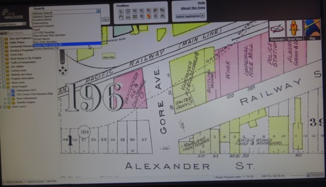
Goad’s Fire Insurance Map
Vancouver Archives has made the Vanmap even more exciting by adding a layer from a 1912 Fire Insurance Plan. Once onto Vanmap click on aerial imagery and you’ll see Goad’s Fire Insurance map. Michael Kluckner took me for a digital tour of his Grandview neighbourhood of 1912 where we found an “Isolation Hospital,” a huge estate called Wilga, and Brook House, complete with its turret. I zoomed into the DTES with CVA archivist Heather Gordon and we could see all the 1912 businesses and brothels along Alexander Street as well as a sawmill and police station, and the original shoreline shown in dashed lines.
The map is colour coded—yellow represents wood framed buildings and the pink are brick and stone—mostly in the downtown area. See Sue Bigelow’s post for a clear description of all its uses.

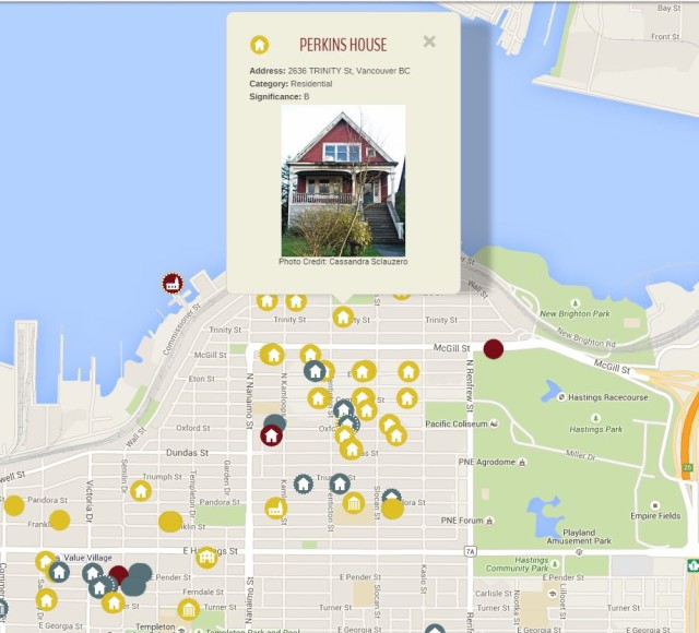
Heritage Site Finder Interactive Map
I’ve spent hours playing on this interactive map by the Vancouver Heritage Foundation. The map lists buildings and landmarks found on the Heritage Register—(and eventually other buildings not on the register) and there are around 2,300, many with photos and descriptions. It’s incredibly easy to navigate and you can search by address, zoom into an area, or just click on houses at random. This is a work in progress, so if you click on a building and can’t find a photo, keep trying. Better still if you have old photos of the building and information, send them to the VHF so they can add them. Eventually it will also be possible to add long demolished buildings so we can see how Vancouver looked through a historical filter.

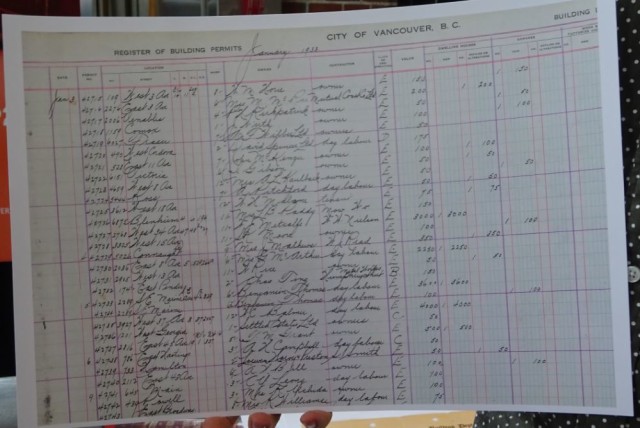
Historic Building Permits online database
You’d think answering a question like ‘when was my house built?’ would be simple. It’s not. Or at least it wasn’t until Heritage Vancouver Society started to transcribe thousands of building permits (currently at 33,000) from the Vancouver Archives prior to 1929—the year Point Grey and South Vancouver amalgamated into the City of Vancouver. Before these permits were online—and it is a volunteer-dependent work-in-progress—you would have to go to the Archives and look through pages and pages of handwritten ledgers brought out to you in huge bound books. With the online database you can pull up every house built in a block, you can search for every building designed by a certain architect, or most impressive and simplest of all, you can find out when your house was built.
© All rights reserved. Unless otherwise indicated, all blog content copyright Eve Lazarus.


