Every Place Has a Story

Riding the Spirit Trail – from Mosquito Creek to Pemberton Avenue (part 5)

the_title()

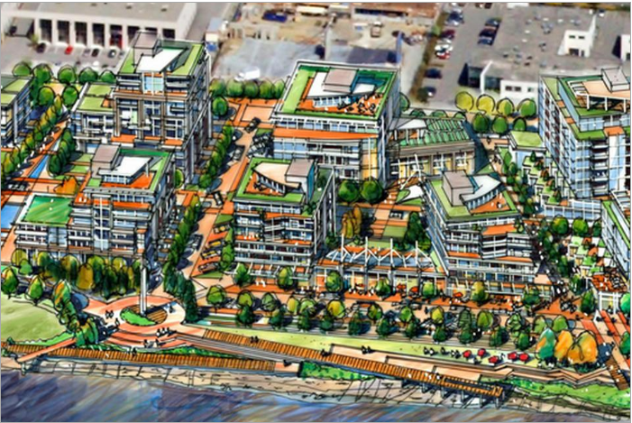
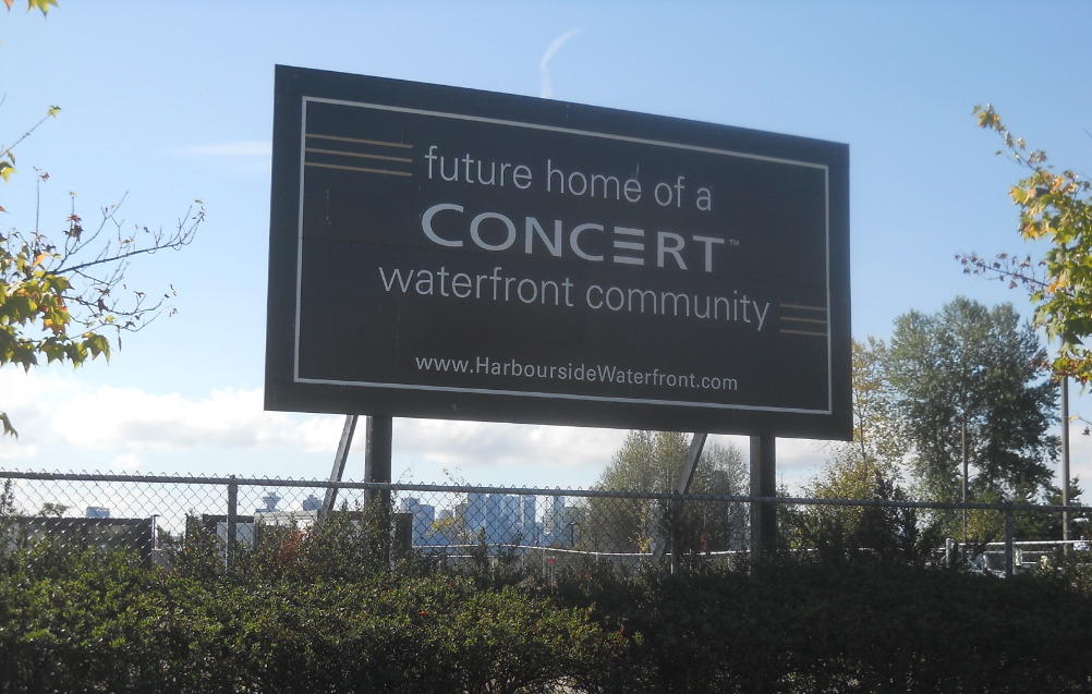
At the end of our last post, we were watching harbour seals at Mosquito Creek. Now we’re going to take the Spirit Trail to Harbourside. While you may see a large tract of vacant land, as well as some businesses, a Spa Utopia, and an auto mall–developers see 700 condos, office space, retail stores, and a hotel.

Did you know that all the land at the bottom of Fell Avenue used to be tidal flats? In the late 1800s, James Pemberton Fell and his uncle Arthur Heywood-Lonsdale, bought District Lot 265 which included the foreshore rights. James had lofty goals that included a million-dollar marina and industrial complex. He got as far as building a seawall and creating 21 acres (8.5 hectares) of additional land before the Great War hit and all infrastructure plans were put on hold.

So, over 100 years later, let’s not go counting those condos until they’re hatched.

Eve Lazarus photo, 2018

Back on our bikes we’re going to ride along the waterfront past the off-leash dog park and take a hard right up Kings Mill Walk and the Harbourside West Overpass and onto Pemberton Avenue.

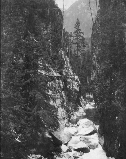
In the early 1900s several different flumes in North Vancouver transported logs and shingle bolts from the forests to the sea. They were long wooden chutes filled with running water, used by loggers like conveyor belts to float cedar shingle bolts from the hills above to the mills below.

Close up of the Capilano River flume in 1916. People used to walk along it in their Sunday best. Courtesy CVA 21-42

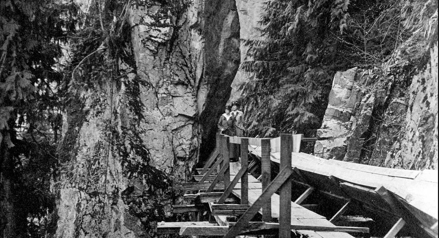
The Capilano River flume was the longest at over 12 kilometres in length. Built in 1905, it ran from Sisters Creek, just north of where the Capilano Reservoir is today, to a mill at the foot of Pemberton Avenue. The flume had a catwalk that ran alongside it so crews could do maintenance, but it was also accessible to the public.

In the early part of the 20th century the Capilano Timber Company had its own railway for transporting fir, hemlock and cedar logs from the upper Capilano valley to the firm’s grounds near the foot of Pemberton. The railway ran down the west side of the Capilano River, crossed the river and headed eastward, running along what is now the Bowser Trail behind Save on Foods. The train crossed Pemberton and Marine drive and headed south and lasted until the early 1930s.

Capilano River Flume (on left) for cedar shakes in 1900. Courtesy CVA 122-1

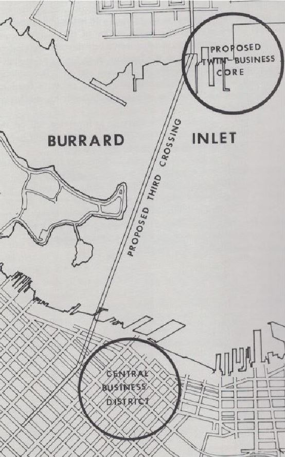
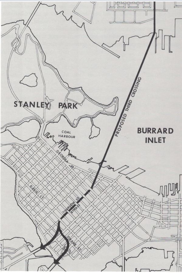
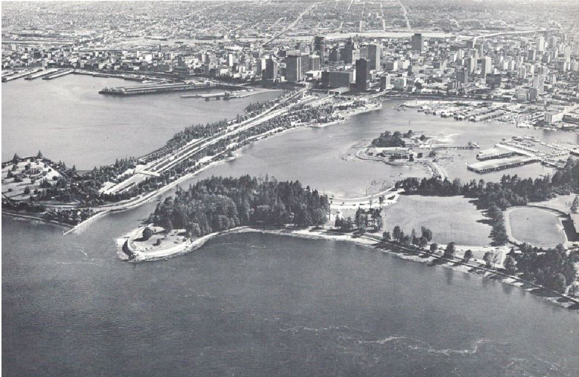
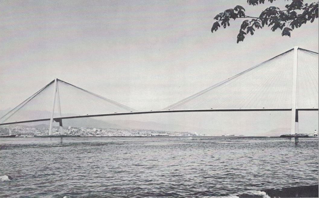
In the 1970s, Pemberton Avenue almost became the jumping off point for the North Shore’s third crossing. Alderman Warnett Kennedy, an architect and town planner lobbied for a tunnel under Thurlow Street that would carry cars and rapid transit to the North Shore over the world’s biggest cable bridge, and exit at Pemberton Avenue.

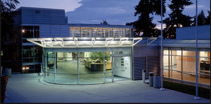
Instead, you’ll find Vancouver Shipyards and the headquarters of Seaspan, the largest tug and barge company in Canada. After winning a federal government contract in 2011 to build 17 ships that include a Polar-class icebreaker for the Coast Guard, the company built a new office on the western spit of the Seaspan property. Seaspan expects to fill it with more than 1,300 new shipbuilding and office staff by 2020.

Next post we’ll be winding through Norgate to Ambleside.

The North Shore’s Spirit Trail – Moodyville (part 1)

Moodyville to Lonsdale Quay (part 2) 

Lonsdale Quay (part 3)

Mosquito Creek (part 4)

Pemberton to Capilano River  (part 6) 
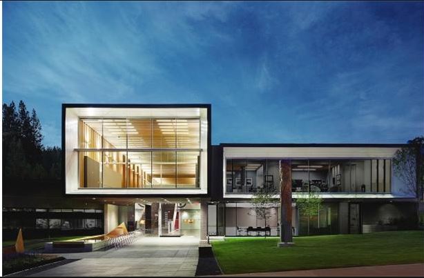
West Vancouver (part 7)

© All rights reserved. Unless otherwise indicated, all blog content copyright Eve Lazarus.

A Tale of Two Vancouvers

the_title()


North Vancouver District Hall

I went to the District of North Vancouver offices to pick up some money owed and was promptly redirected to the City of North Vancouver offices five minutes down the road. It made me wonder yet again why we are running two completely separate bureaucracies for a relatively small population. It also made me think about Warnett Kennedy’s plan to turn North Vancouver into a second downtown Vancouver.

North Vancouver City Hall

A couple of months back I wrote about Kennedy’s planned third crossing for Burrard Inlet which was debated and promptly tossed out back in the early 1970s. In the same book Kennedy, who is described as an architect, town planner and City of Vancouver Alderman, outlines his ambitious plans for a crossing that would include rapid transit to the North Shore. He also argues for a Twin City.

“The Twin City Concept combined with a Third Crossing would be enormously useful,” he writes. “Hopefully a time will come when we talk of “Vancouver One” and “Vancouver two.”

His idea was to take development pressure off the Fraser Valley, and presumably move it onto the North Shore.

From a 1974 book called Vancouver Tomorrow: A search for Greatness

In this vision of two downtown Vancouvers—one which looks like it would be at the bottom of Pemberton in North Vancouver—Kennedy wrote that Burrard Inlet would be seen as “a lake in the centre of this future regional city.”

“I have often been asked to explain the reasons for my proposal first published in 1972 for a twin downtown Vancouver. Although it appears somewhat startling, the logic of the idea is essentially simple,” he says. “If a rapid transit link were to exist today it would take only four minutes running time to travel from Vancouver’s Central Business District to a Central Business District on the North Shore.

West Vancouver Municipal Hall

“It would be as though Vancouver had reached out and pulled the North Shore almost alongside its downtown. The water of the harbour, in imagination and for all practical purposes, is narrowed to a river’s width.”

I’ve lived in North Vancouver for a couple of decades now and I found his argument for the twin city less than compelling.

The chapter ends on the optimistic note that all that was needed to get this plan off the paper was that North Vancouver City, and the District of North Vancouver and West Vancouver would amalgamate with their “mother city” Vancouver.

Good luck with that.

Vancouver City Hall
Vancouver City Hall


Aborted Plans: A Third Crossing for the North Shore

the_title()

I spent the last three months of 2015 working on an interactive project called Water’s Edge for the North Vancouver Museum and Archives. We started at Indian Arm and went a little west of Ambleside to find the stories that would show the massive changes that have happened to the shoreline and to Burrard Inlet.

One of my favourite parts was looking at the many changes that didn’t happen such as the much talked about third crossing to the North Shore. The most recent plan  was laid out in a book published in 1974 called Vancouver Tomorrow: A search for Greatness, by Warnett Kennedy.

Aborted Plans 3rd crossing Warnett map

Warnett was a Scottish-born architect, town planner and City of Vancouver Alderman who arrived in 1952 to develop Annacis Island. The Greater Vancouver Book writes: “Kennedy imagined what he called a ‘wet village on the west coast’ transformed into a megalopolis, where vertical take-off aircraft would take citizens from the roofs of the West End’s 100-storey apartment buildings to homes in the suburbs—the peaks of Grouse and Seymour. Key to his vision was the idea that tourists and future residents would come to mountaintop chalets to gaze out over the Fraser Valley’s farmlands, which, overdue for a massive flood anyway, would have been left untouched by suburban sprawl.”

Clearly, Warnett missed the mark there—no 100-story apartment buildings yet fortunately–the Shangri-la is the highest at 62 stories. Although aircraft pick up from my North Vancouver rooftop does sound like a pleasant way to avoid traffic jams and road rage.

But speaking of gridlock, there’s still no third crossing either.

"People are nervous when it is proposed to tamper with a loved environment. a tunnel, although more expensive, is apparently the popular choice (Vancouver Tomorrow: a search for greatness)
“People are nervous when it is proposed to tamper with a loved environment. a tunnel, although more expensive, is apparently the popular choice” (Vancouver Tomorrow: a search for greatness)

Warnett writes: “One might think that the water which separates the North Shore from Vancouver’s downtown was the Grand Canyon. This mindlock has to be broken. It stultifies imagination in planning.”

Warnett’s idea for a third crossing would continue along from a tunnel under Thurlow Street. Cars and rapid transit would cross to the North Shore just by Brockton Point over the world’s biggest cable bridge, and exit at Pemberton Avenue.

The world's biggest cable-stayed bridge off Brockton Point would be 8% less costly than a tunnel on the same alignment (Vancouver Tomorrow: A search for greatness)
“The world’s biggest cable-stayed bridge off Brockton Point would be 8% less costly than a tunnel on the same alignment,” (Vancouver Tomorrow: A search for greatness)

Makes you wonder though. More than 40 years has passed since that proposal was rejected and North Vancouver is still without a third crossing or a direct connection to Vancouver’s rapid transit system.

Next Week: Warnett Kennedy’s Twin City Concept

© All rights reserved. Unless otherwise indicated, all blog content copyright Eve Lazarus.