Every Place Has a Story

Riding the Spirit Trail from Pemberton Avenue to the Capilano River (Part 6)

the_title()

Last week we stopped our ride at Pemberton Avenue. Today we’re going to cross the border into West Vancouver.

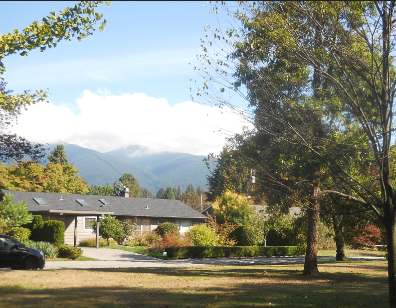
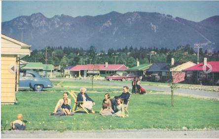
The first part of the Spirit Trail winds through Norgate, a quiet neighbourhood filled with mid-century ranchers built during the post-war boom period. But did you know that the whole area was originally intended to be the Capilano Air Park?

A typical Norgate rancher along the Spirit Trail. Eve Lazarus photo, 2018

It was first proposed in 1945 and the idea was that it would cater to tourists flying their own planes from other parts of North America. There would be two runways and construction would  start in 1947 and include luxury accommodation. In the end, we couldn’t afford it and the land was sold to Hullah Construction for a subdivision.

1950s newspaper ad promoting Norgate as a family-friendly neighbourhood. Courtesy NVMA

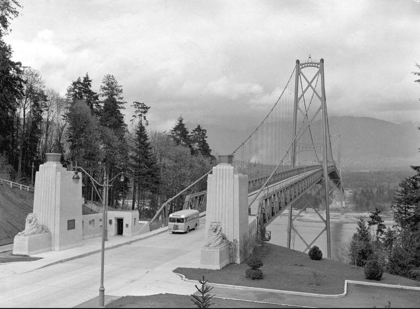
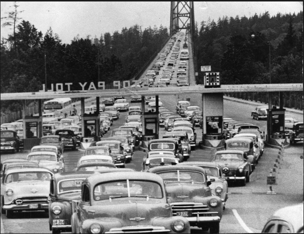
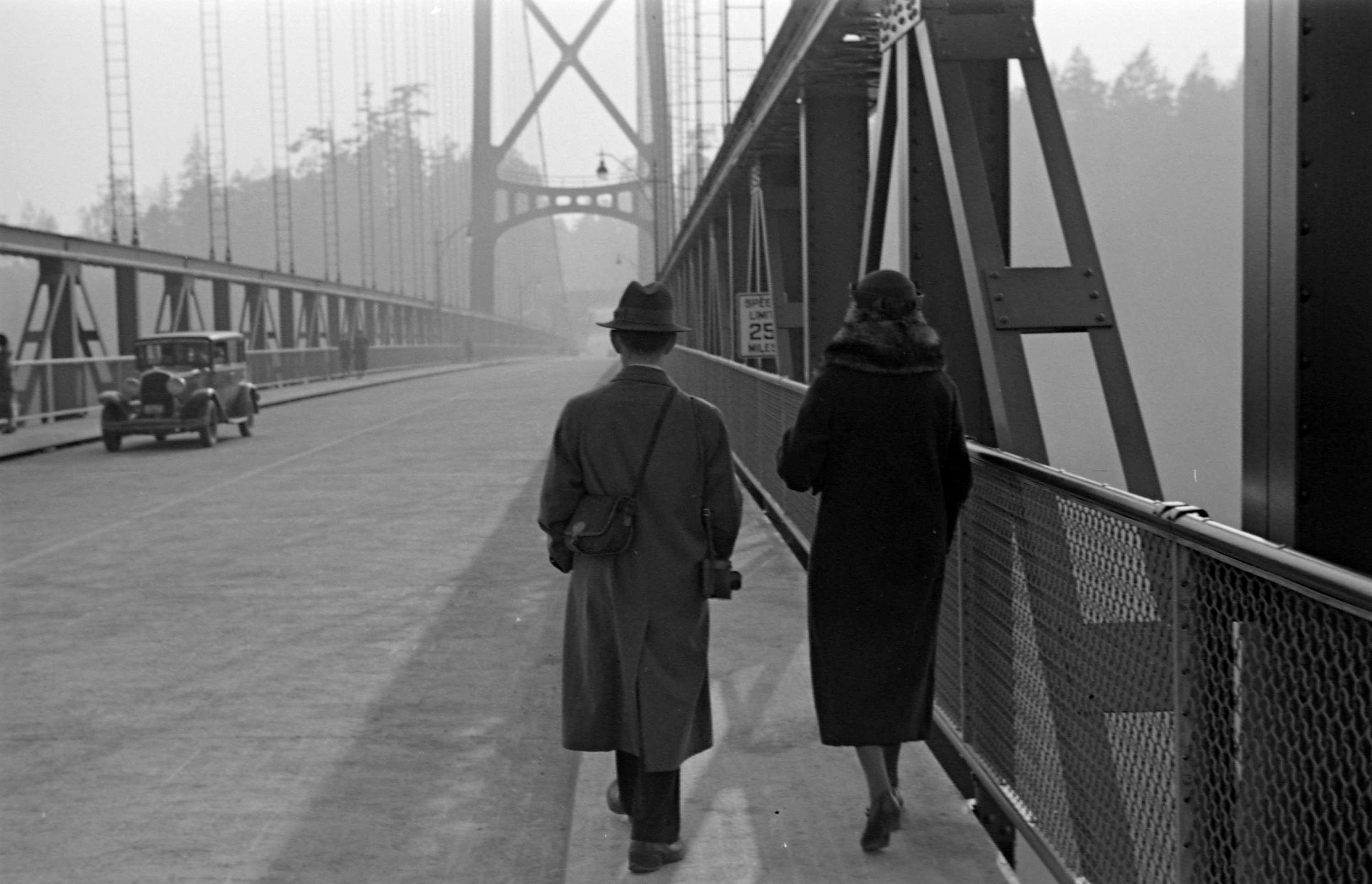
After we pass through Norgate, it’s a quick ride to the road that leads to the Lions Gate Bridge, built in 1939 by the Guinness brewing family. The provincial government later bought the bridge and the toll came off in 1963.

Now a National Historic Site of Canada. Photo courtesy Vancouver Sun

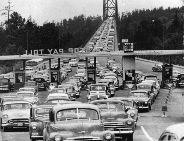
In 1982, a group of UBC engineering students suspended a Volkswagen Beetle from the bridge. On the first night, a group of students attached a cable under the bridge. On the second night, students drove a jeep towing the reinforced Beetle. The students detached the car, slipped a cable under its roof, attached the other end to the side of the bridge, and pushed the car over the railings.

As we approach the Capilano River and West Vancouver, it’s pretty clear that the district (named by Macleans Magazine as the richest postal code in Canada last year) is not spending its net worth on the Spirit Trail. In fact, it’s lack of enthusiasm is downright dangerous as you cross the bridge that takes you over to Ambleside.

But in 1913, it wasn’t cars that you had to worry about. The sand and gravel that washed down the Capilano River had built up on the north side of First Narrows to such an extent that ships were grounding, especially in bad weather. In July of that year, George Alfred Harris became the first lightkeeper at the newly constructed First Narrows Lighthouse.

The Capilano Fog and Light Station 1914. Coutesy WVA 0032.WVA.PHO

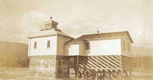
The lighthouse, and the keeper’s house sat on pilings at the mouth of the Capilano River, and except for very low tide, the Harris family was surrounded by water. The lighthouse operated until 1968.

Top photo: Walking over the Lions Gate Bridge in 1939. Courtesy CVA 260-995

© All rights reserved. Unless otherwise indicated, all blog content copyright Eve Lazarus.

Next time, we’ll be riding through Ambleside and along to Dundarave where the Spirit Trail ends for now.

If you’ve missed any of the rides, please see:

The North Shore’s Spirit Trail – Moodyville (part 1)

Moodyville to Lonsdale Quay (part 2) 

Lonsdale Quay (part 3)

Mosquito Creek (part 4)

Harbourside (part 5) 

West Vancouver (part 7)

Saving History: Twinning the Lions Gate Bridge

the_title()
Lions Gate Bridge in 1940. Courtesy CVA 586-462

From Vancouver Exposed: Searching for the City’s Hidden History

Last year, Daien Ide, reference historian at the North Vancouver Museum and Archives was sitting at her desk when she got a tip. A 1994 model of a proposed Lions Gate twinned bridge had turned up at the Burnaby Hospice Thrift Store on Kingsway with a $200 price tag.

A local had saved the model after finding it tossed out in an alley behind his house a couple of decades earlier. For whatever reason, he decided it needed rehoming, and gave it to the thrift shop.

Vancouver Sun photoThe Lions Gate Bridge spans the first narrows in Burrard Inlet, connects Vancouver to the North Shore, and is one of the most iconic structures in the city. Built by the Guinness family to encourage development after they bought the side of a West Vancouver mountain, the suspension bridge was tolled from the time it opened in 1938 until 1963.

It cost 25 cents for cars and five cents for pedestrians.

By the early 1990s, the bridge was in serious need of an upgrade or replacement and the City narrowed down the options to three proposals. One was to build a tunnel; another to twin the bridge and double the number of lanes; and the third was to double-deck the existing three-lane bridge.

In 1994, Safdie partnered with engineering firm SNC Lavalin, and the Squamish Nation, which owned the land on the north end of the bridge.

They wanted to build an identical bridge to the east of the original structure that would carry northbound traffic, while the original bridge would carry vehicles south into Stanley Park. The new bridge would be tolled, and judging by the model, cut a chunk out of Stanley Park.

The scaled model is clearly identified with the name of the architectural firm—Safdie Architects. In Canada, Moshe Safdie is a highly regarded architect, known for the Expo 67 Habitat in Montreal, the National Gallery in Ottawa, the Montreal Museum of Fine Arts, and our very own Vancouver Public Library.

As we now know, the Province chose the cheapest and least controversial option, electing to widen the three-lane existing bridge and replace the main bridge deck.

In 2005, the Lions Gate Bridge was designated a National Historic Site of Canada.

Our traffic problems persist.

© All rights reserved. Unless otherwise indicated, all blog content copyright Eve Lazarus.