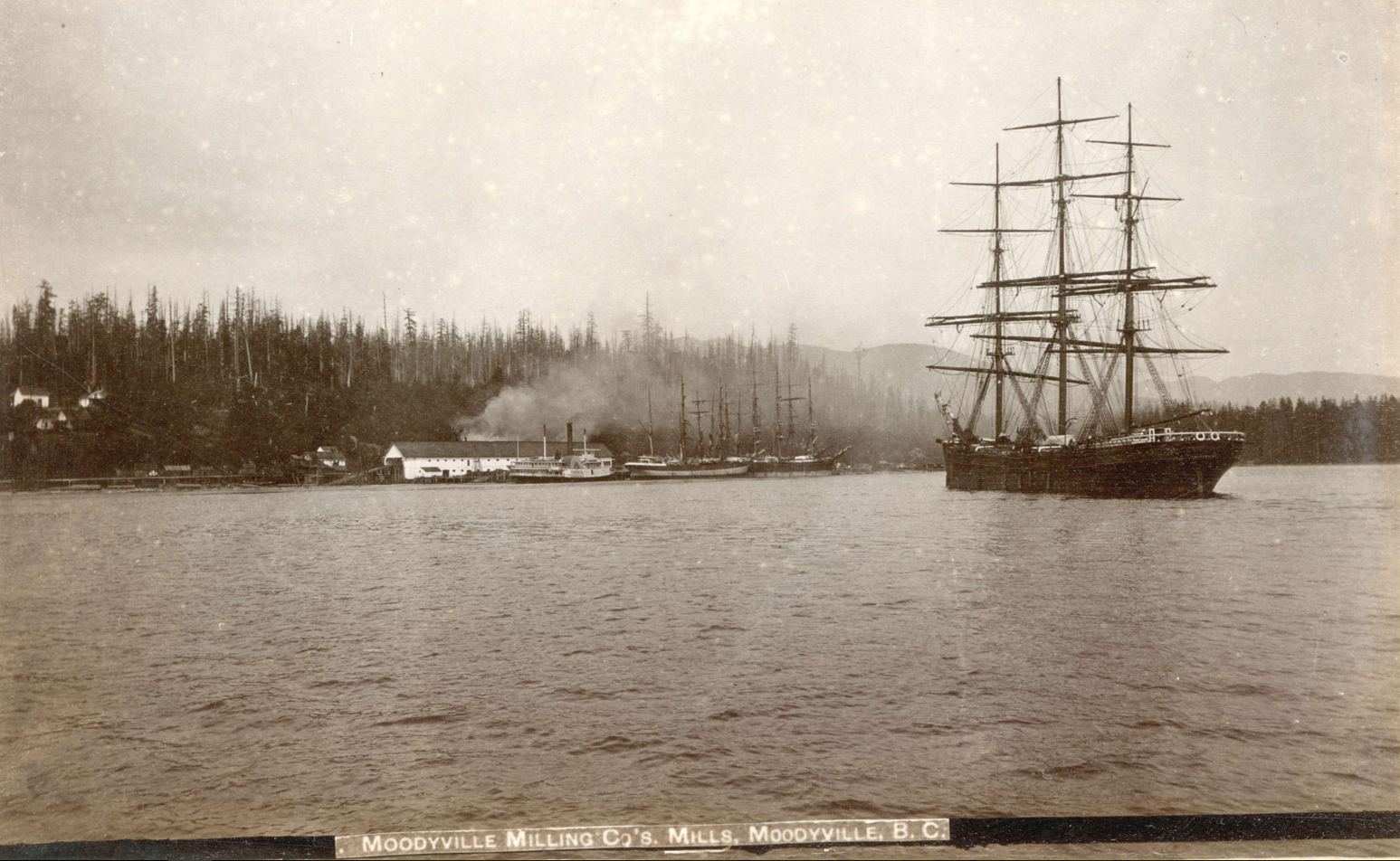
Every Place Has a Story

The North Shore’s Spirit Trail – Moodyville (part 1)

the_title()


In May 2014, the City of North Vancouver inked a deal with the Squamish Nation and moved a step closer to realizing the dream of building a 35-kilometre waterfront trail that would wind its way from Deep Cove to Horseshoe Bay.  The mostly finished portion of the Spirit Trail runs from Sunrise Park (just above Park and Tilford Gardens) to 18th Street in West Vancouver–(just past John Lawson Park). The ride (or walk) along the finished portion is about 20 km return.
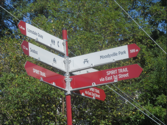
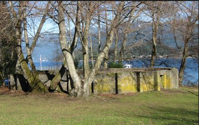
The Moodyville Park section was completed in 2015. The trail includes an impressive overpass to Heywood Street, a mini-suspension bridge, public art, and some now fading public markers. You’ll have to reach deep down into your imagination, because the only thing left of Moodyville is a small park with some signage surrounded by a lot of building activity.
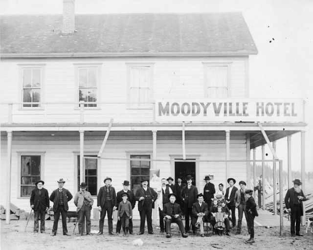
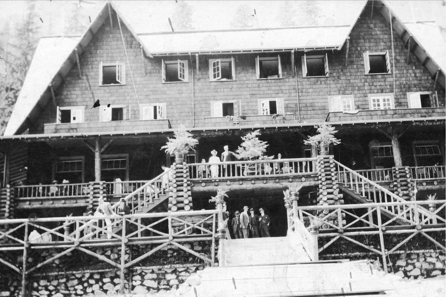
A two-storey hotel opened in 1883 and it was reportedly “a comfortable and exceedingly well-managed” operation, with a bar stocked with top wines and liquors, and where “drunkenness was unknown.” The Columbian, photo NVMA 1900

Up you go over the new overpass, and a great view of the working waterfront that takes you right into Moodyville, once a thriving town built entirely around lumber. Settled in the early 1860s, the town was completely distinct from the rest of North Vancouver with a business district that included a library, Masonic lodge, school, jail and cookhouse situated where the railway tracks and grain elevators are today. The mill was at the foot of what is now Moody Avenue, and a wooden wharf extended from the mill out over deep water. The town even had its own ferry service.
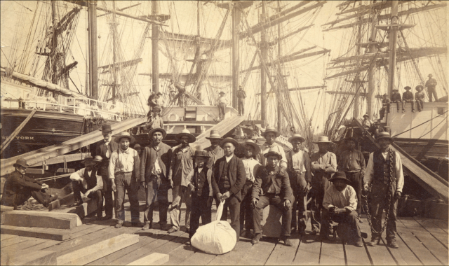
William Nahanee (with laundry bag) and a group of longshoremen on the dock of Moodyville Sawmill in 1889. CVA Mi P2

While the workers were comprised of several different races who could trace their origins back to Europe, Asia, the Pacific Islands “Kanakas,” Latin America and the West Indies, lived in segregated housing; the wealthy lived in “Nob Hill” a nod to San Francisco’s prestigious neighbourhood.

The most prestigious house was Invermere, known as the “Big House” and built in the late 1870s for Hugh Nelson a partner in the Moodyville Sawmill Company (later Lieutenant Governor of BC). Lumberman John Hendry bought Invermere and lived there for a time. His son-in-law Eric Hamber, another Lieutenant Governor of BC, demolished the house after his death. The replacement house is at 543 East 1st Street.
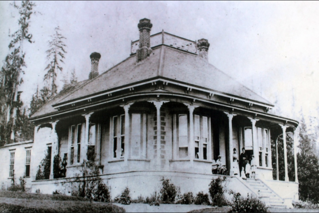
The Big House in 1881. Courtesy NVMA

Electricity came to Moodyville in 1882, a full five years before Vancouver and the electric lights reflected all the way across the waters to Hastings Mill in Vancouver.  Moodyville was the first town site north of San Francisco to sport electric street lights.

By 1898 the Mill’s fortunes had peaked and in 1901 it closed.  People moved away in search of work, and business activity shifted to the waterfront at the foot of Lonsdale Avenue. Moodyville officially became part of North Vancouver in 1925.
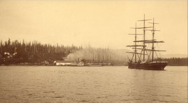
“Moodyville was the largest, oldest, most prosperous and certainly most decorous settlement on the Inlet. It had a population of several hundred, all respectable families, with tidy homes strung along well-laid out streets up the hillside from  Moody’s mill.” Photo ca.1890 CVA Mi P22

The Low Level Road, constructed two years later, paralleled the railway line.  Much of the hillside was scraped away and re-deposited as fill on the tidal flats to reclaim 15 acres (6 hectares). Midland Pacific was first to locate on the fill and opened a grain elevator in 1928. The area known as Nob Hill was subdivided, war-time housing followed, and a housing development called Ridgeway Place sold in the late 1950s.

With thanks to the North Vancouver Museum and Archives for letting me work on their  Water’s Edge Exhibit in 2016.

Moodyville to Lonsdale Quay (part 2) 

Lonsdale Quay (part 3)

Mosquito Creek (part 4)

Harbourside (part 5) 

Pemberton to Capilano River  (part 6) 

West Vancouver (part 7)

© All rights reserved. Unless otherwise indicated, all blog content copyright Eve Lazarus.

Water’s Edge at Presentation House

the_title()

Next time you’re in the Lower Lonsdale area, drop by Presentation House and check out Water’s Edge. It’s a new interactive exhibit developed by the North Vancouver Museum that shows how the waterfront has changed over the last couple of hundred years. I did the research and wrote the stories, archivist Janet Turner sourced hundreds of photos and maps, and Juan Tanus and his team at Kei Space added the magic. The result is a really interesting look at how industry, infrastructure and development have changed the coastline all the way from Indian Arm to Ambleside.

Water's Edge at Presentation House
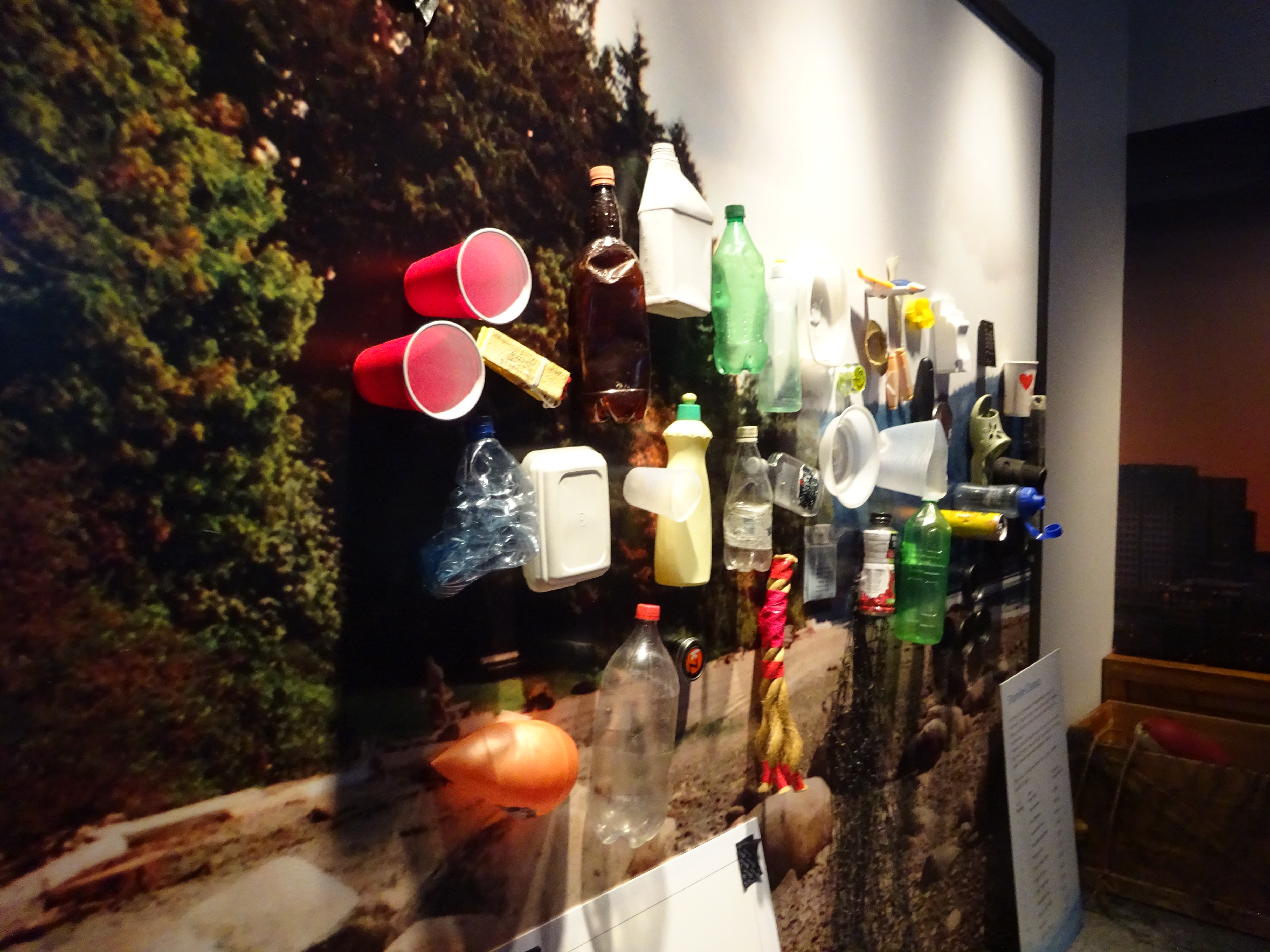
Flotsam and Jetsam wall for making your own art assemblage on set-up day.

The sound effects add to the whole experience, as does a floor to ceiling slide show of the blue cabin and accompanying video, as well as a wall of flotsam and jetsam. One of my favourite touches is the two benches from the old ferry building at the bottom of Lonsdale.

Water's Edge at Presentation House
Carole Itter outside the blue cabin where she lived with Artist Al Neil for nearly 50 years. Photo courtesy North Shore News

North Van has so many stories that it wasn’t hard to come up with close to 100.

Water's Edge at Presentation House
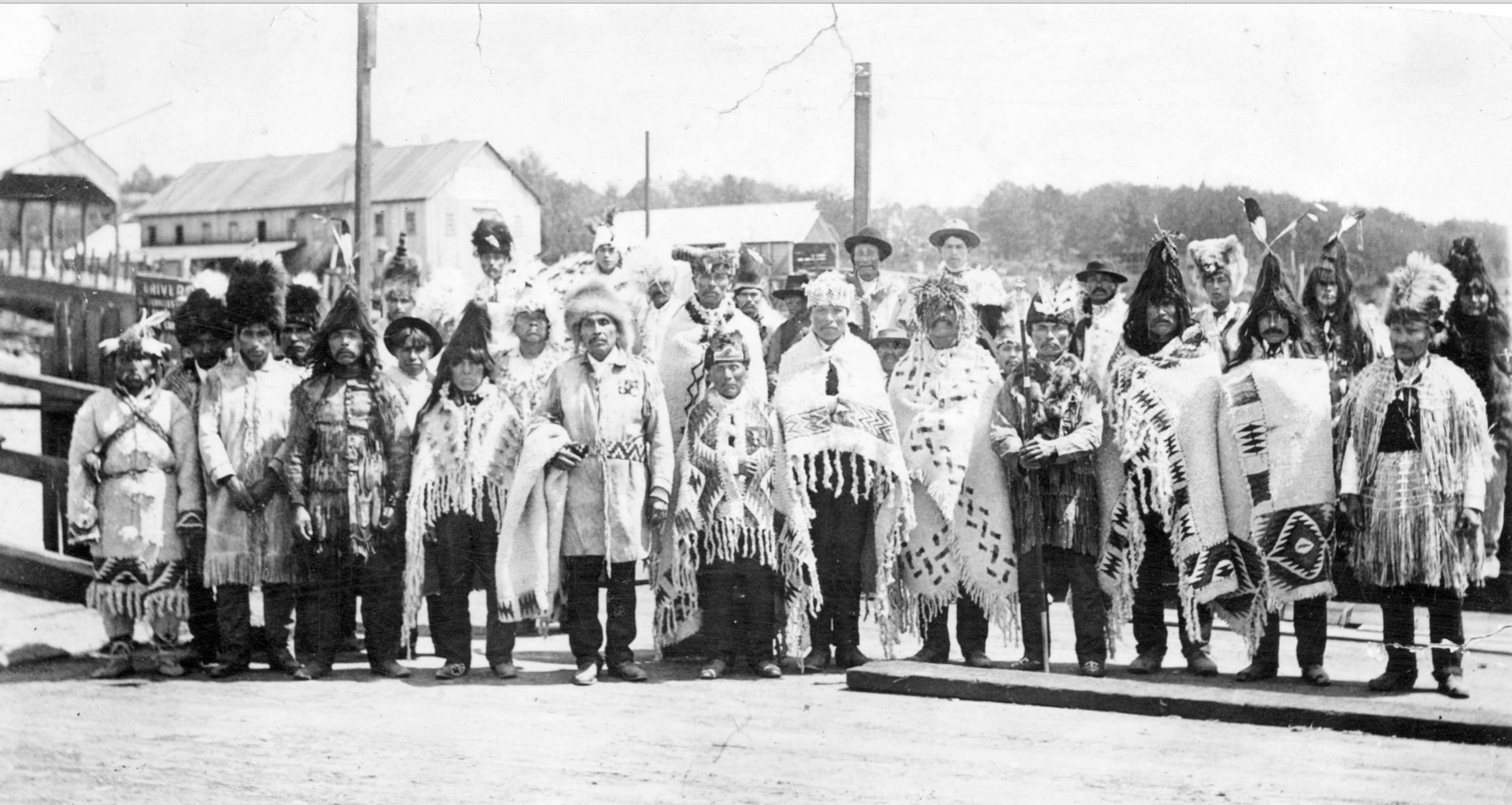
In 1906, Joe Capilano headed up a delegation and sailed off to England to meet the King. They are at the North Vancouver ferry dock. CVA In P41.1

One of my favourite stories is the streetcar that hurtled down Lonsdale in 1909 dumping all of its passengers, including the mayor’s wife, into the water.

Several stories came out of Maplewood, which has seen its coastline change from mudflats to a sand and gravel quarry to squatter shacks. Public protest saved the area from becoming another shopping centre, and it’s now a wild bird reserve that’s home to 246 different bird species.

Water's Edge at Presentation House
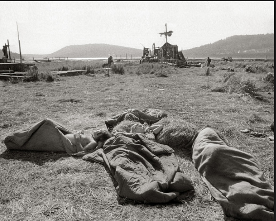
Early morning at the Dollarton Pleasure Faire, 1972. Bruce Stewart photo

Indian Arm has a plethora of stories. There’s the Wigwam Inn built by Alvo von Alvensleben in 1909. Canada’s only floating post office operated from 1908 to 1970 up and down Burrard Inlet, as did a floating grocery store which visited 25 different wharves five days a week in summer and three in winter. In 1891 Sarah Bernhardt took some time off from her performances at the long defunct Vancouver Opera House and went duck shooting at Indian Arm.

Water's Edge
Wigwam Inn, 1910. Built by Alvo Alvensleben the Inn attracted people like John Rockefeller and John Jacob Astor. CVA OUT P991.2

There’s stories from what was once Moodyville, named after Sewell P. Moody who went down on a ship in 1875, but not before leaving a message on some driftwood that said “S.P. Moody all lost.” And there’s the fire at the grain elevators 100 years later that claimed five lives.

Water's Edge
Moodyville in 1890. CVA 1376-75.10

Many stories come from the Mission Reserve. Their lacrosse team won the 1932 BC Championship. Emily Carr visited several times, painted and wrote about the area, and there are the very unpleasant stories that came out of the Residential School that sat near St. Paul’s Church until its demolition in 1959.

Some of the really amazing stories were the ones that didn’t happen—the aborted plans such as the Capilano Airfield, and if that had gone ahead, would have turned North Van into a very different place than it is today.

Water's Edge at Presentation House
Do you know this strange cement structure in Little Cates Park? That’s the remains of a waste burner from a mill that closed in 1929.